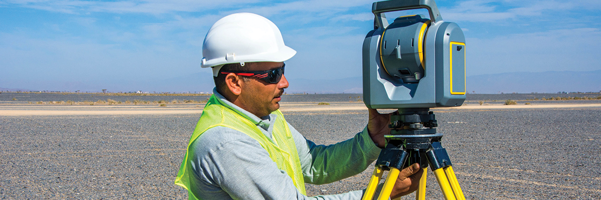
3D LiDAR (Light Detection and Ranging) Scanner is a remote sensing technology which uses the pulse from a laser to collect measurements which can then be used to create 3D models and maps of objects and environments. It gives a high accuracy data in Point Cloud with exact geo referenced coordinates and measurement which creates a 3D representation of the target object or area. Being the data available in three dimensional measurements it is commonly used in Survey for getting the natural / built environment such as buildings, roads, pipelines, quantity calculations, data classification as well as creating digital terrain (DTM) and elevation models (DEMs) of specific landscapes.
Area of Application
As Built Survey
Topographic Survey
Site Condition Survey
Volumetric Survey
Mine Survey
Archeological Survey
Heritage and Conservation Survey
Road / Pipeline Corridor Survey
Building Information Model (BIM)
Deliverables :
2D plans & elevations in Auto CAD
Point to Point measurable Point Cloud Data
Detailed Topographic and Contour maps with report.
 English
 العربية